- You have no items in your shopping cart
- Continue Shopping
$ 95.04
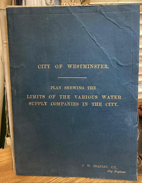
Cloth-backed fold-out map, with gilt lettering to cloth. Minor rubbing and fraying of cloth. Colour toning to show certain districts and blue boundary lines drawn onto the map to show the limits of the water supply companies. Stamp of City Engineer's Office, dated 1902. Bradley was a city engineer and surveyor. Scarce. 72cms tall, 90cms wide (unfolded). Title: City of Westminster: Plan Shewing the Limits of the Various Water Supply Companies in the City Author Name: Bradley, J. W. Location Published: London, G. W. Bacon & Co., Ltd 1902: 1902 Binding: Cloth Book Condition: Very Good Size: 8vo. Map Categories: London, Maps and Atlases, York Bookfair Book number: 72819 Keywords: hyde park, knightsbridge, london, utilities, water, west end, westminster
Related products